It’s been a while since I posted about a walk on here. It’s
not for lack of days out. It’s just that I’ve been trying to write the tale of
my Cuillin Ridge traverse and struggling to get it to a reasonable length
(unlike the walk itself). It’s going to be a tale of disappointment and joy.
Pain, exhaustion and seafood. And camping. But having written just about the
experience so far it’s something like the length of a short novel. And you don’t
want that.
In the meantime I thought I’d share a shorter tale of a
longer walk I did a few weeks after the Cuillins. Welcome to the Rhinogs! Or
Rhinogau. Or whatever you want to call this remote, lesser visited corner of
north Wales sandwiched between the more famous regions of Nantlle and Cadair
Idris.
I’d been looking into traversing the secretive Rhinogs for a
while, and found there’s a lack of useful information on the internet apart
from a couple of walk reports on Walkhighlands, next to nothing in any of my
books, and so I just bought a map and tried to figure it all out myself.
The first challenge was logistics. There’s no way of making
this 20-something kilometre traverse into a circuit walk so start and end at
your car. There’s trains and buses but timings are irregular. But I thought I
had it more or less figured out to get it done over a weekend, and still be
back at work in Bristol by Monday morning.
My plan was to drive to Barmouth Friday evening, catch the
train to Llandecwyn on Saturday morning at 10am, walk south across various
mountains and wild camp along the way, then end up back in Barmouth Sunday
afternoon ready to drive home.
The first challenge was to find somewhere to stay. I rang
the nearest campsite to Barmouth the week before and was told in no uncertain
(and actually somewhat unfriendly) terms that under no circumstances would the
campsite accept the two of us (me and regular mountaineering bud Joe) turning
up around midnight and pitching up for the night. There was no way I was going
to pay for a B&B for a few hours sleep, so we drove up Friday evening with
nowhere to stay, and hoping to just find somewhere we could pitch up.
Barmouth isn’t really like that. Even when we arrived at
midnight the town was really busy, and the narrow strip of town doesn’t lend
itself to a roadside wild camp! In the end, in desperation we drove back in the
direction of Dolgellau and found a layby set back from the road which already
had a couple of cosy looking camper vans in it, and we set about finding a way
in which two grown men could sleep in a Peugeot 106. Needless to say that’s not
easy. Somehow Joes ended up across the two front seats with a handbrake in his
ribs, and I found myself folded into an L shape with my feet numb with cold in
the boot and my head on the remaining back seat of the car.
After an uncomfortable nights “sleep” we got up with the sun
around 6am and drove into Barmouth to see if we could find a place to safely
leave the car for a night without getting ticketed. A call to the tourist
information centre about this prior to our arrival resulted in total misinformation.
They’d told me there were no parking restrictions along the seafront; this is a
lie. Luckily not far west of the main town parking restrictions ended so we
parked the car on the street and went looking for breakfast. Which was hard to
find as nowhere in the town opens until 9am!
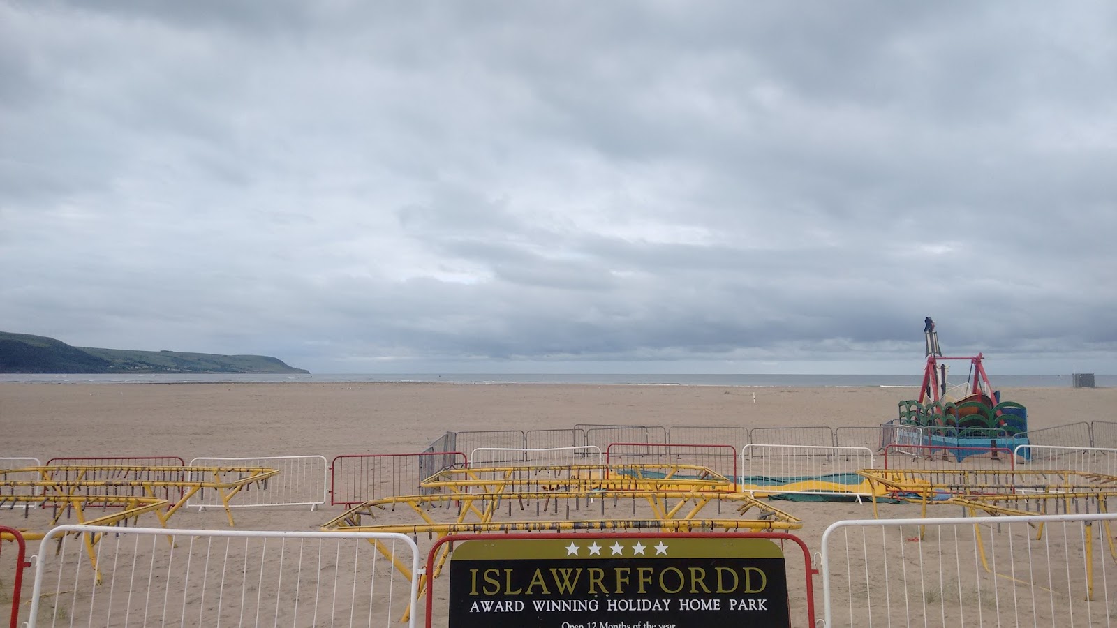 |
| Barmouth seafront |
Nonetheless we got dropped off in a layby at Talsarnau and
were finally on our way in glorious sunshine with Moel-ddu looming to the north
of us and the Rhinogs hidden to our south east side.
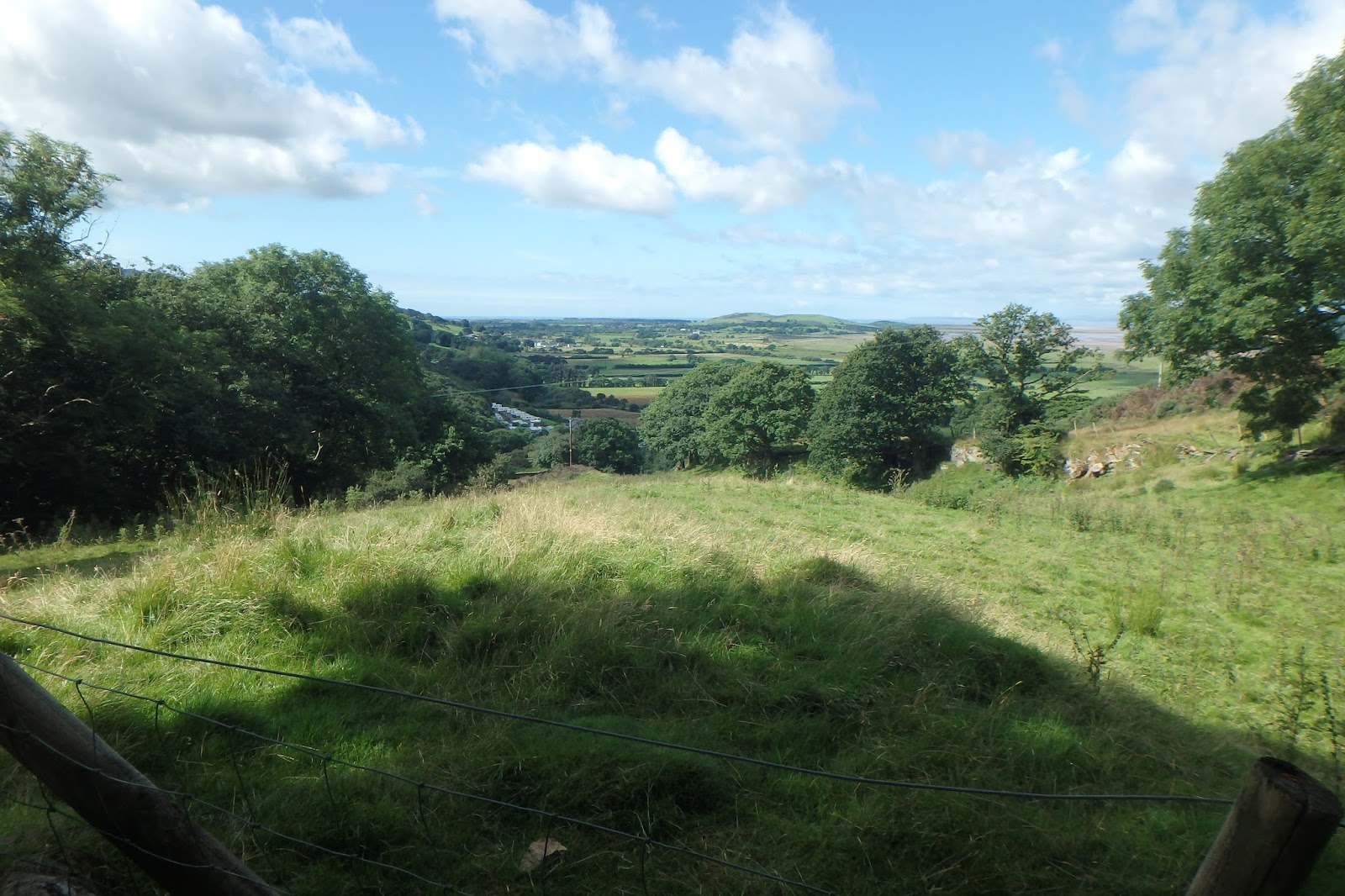 |
| The start of the walk |
 |
| Eisingrug |
The early part of the journey is an easy meander alongside
roads and meandering paths over small hills, beside lakes and into remote
farmland. Here we bumped into an extremely friendly lady and her dog who’d just
completed the same traverse but from south to north. We exchanged notes and
plans and she went off in search of well-deserved beer and relaxation, while we
hitched up our bags and pressed on to start the first real slog from Nant
Pasgan-bach to Diffwys. With heavy loads the ascent took a lot of effort but it
felt amazing to be in such a remote part of Snowdonia with no one else in
sight.
 |
| Heading for Diffwys |
From atop Diffwys we could see the way ahead more clearly,
over rough patchy terrain of loose stone, steep cliffs and endless heather and
scree. From Diffwys we headed south west to the rocky summit of Foel Penolau,
before skirting its steep ramparts to scramble down to the col between it and
Moel Ysgyfarnogod, and another steep grassy trudge to the summit cairn there.
From Moel Ysgyfarnogod the true nature of the Rhinogs was
visible stretched out before us. Looking due south the land was split; on the
right a steep, layered craggy plateau of stone, heather and bilberry. On our
left a deep valley of streams and bog with thick forest far to the east.
In much of the Rhinogs well constructed walls are key
navigational features which point the way. Far to the south we could see a wall
that we knew led the way to the path we could follow, but to avoid losing
height we contoured around the plateau heading over Craig Ddrwg before descending
a steep gully with an incredible dry stone wall built right up into it to meet
the path.
Much of the ground was treacherous. Heather and bilberry
covers the rocky ground and occasional holes in the rough stone and we
frequently lost our lower legs into these, meaning our going was slow and
cautious.
 |
| Looking south to the Rhinogs |
 |
| Rocky plateaus and deep valleys |
Once on the path we could follow this easily to Cwm Bychan
at the head of Llyn Cym Bychan. The boggy way down was lost from time to time
in deep ferns but we battled our way down through these over more treacherous
ground to reach the campsite at the head of the llyn. Here we once again bumped
into the lady we’d met at the start of our day. I wish I’d got her name as it
would be nice to be able to thank her personally on here for the help she gave
us before we headed off on the next leg of our journey. Her hints were
invaluable!
Our plan had always been to camp below Rhinog Fach at Llyn
Hywel, but the afternoon was already well advanced and we knew we had a long
way to go. As we headed up the Roman Steps in the direction of Rhinog Fawr most
people we passed were on their way down from the mountains and heading home/to
their campsite for the evening. We were definitely the only people still headed
upwards.
The Roman Steps route was the most well constructed and well
maintained path we’d been on all day and it was a relief for our feet and legs
not to be bashing through heather and potholes for a few kilometres.
 |
| Looking south to Rhinog Fach, Llyn Hywel and Y Llethr, with Cadair Idris in the distance |
After the steep dash up to Llyn Du nestled below the steep
and rocky summit of Rhinog Fawr we knew time was pressing on. And we knew our
destination for the night was still a good couple of hours away. We stashed our
bags at the llyn, and, unburdened very quickly rounded the north side of the
llyn and scrambled to the summit of Rhinog Fawr in no time at all. Moving
without all our kit on was absolute joy by this time! The sun was still warm
and we enjoyed for a couple of minutes the view south to Rhinog Fawr, which
seemed so close from the summit. But at the same time we could see just how far
we would have to descend to reach the entrance to the cwm which would allow us
up to Llyn Hywel.
Back at Llyn Du we grabbed our stuff and followed the
directions we’d been given back at the campsite to pick up the path at the
large wall that tracked roughly south west from Llyn Du and contoured around
the lower ramparts of Rhinog Fawr.
From here the navigation was easy, but the going remained
tough where the heather covered ground hid lethal holes. I kept my strength up
with endless handfuls of bilberries which were literally everywhere carpeting
the hillside.
It seemed to take forever to reach the path that followed
the river to the entrance of the cwm headed up to the llyn were aiming for, and
we were both getting tired. We were really feeling the lack of sleep from the
night before. The trek up the cwm seemed to take forever, and a few times we
thought we were close to the llyn we reached yet another deceptive plateau.
Finally, just as the sun was setting, around 9 hours after we’d set off we
reached the shores of Llyn Hywel. A few tents were already pitched at this
remote wild camping spot, and we headed to the south side of the llyn to catch
the last of the warmth from the setting sun and pitched our tents on wide
patches of soft heather away from the boggy and midgey sides of the water.
 |
| Approaching Llyn Hywel |
 |
| Tent up at sunset |
 |
| As the sun went down, keeping warm with the hip flask |
It was at this point that Joe realised his vegan gluten free
boil-in-the-bag curry he’d been looking forward to all day was sat safely in a
bag on his kitchen side in Bristol. As all of my food was full of the joys of
meat and gluten I didn’t have much to offer him, so he had to make do with hummus
and sulking while I ate my dinner. I soon cheered him up with whiskey as the
evening began to get very cold. Once the sun was gone it got really cold. At
around 530m Llyn Hywel isn’t exactly a high wild camp, but it seemed enough to
make hanging around outside uncomfortable. Plus we were both exhausted so an
early retirement to my tent seemed perfectly acceptable.
We awoke the next morning to thick low cloud, and breakfast
and breaking camp was over before the sun came out to lift the fog and reveal
the views to the sea to our west.
 |
| Breakfast brew at sunrise |
To the eastern side of Llyn Hywel a narrow col topped by a
high wall separates the rocky summit of Rhinog Fach from the broad, grassy
summit of Y Llethr. We left our bags at the lowest point of the col leant up
against the wall and followed a steep path to the summit. From here we could
see an outstanding looking rock line up the steepest route to the summit which
we will definitely head back for one day. The cloud was thick at the top and
views were non-existent. We headed back to the col and chatted for a few minutes
with some of our fellow wild campers who were heading to the summit before
making their way back down toward Llanbedr.
Y Llethr, despite being the highest point of the walk, was
probably the easiest summit to reach. Set back from the steep grassy sides of
the peak a rounded summit led to a cairn. From here the route south to Barmouth
looked easier; a series of wide, rounded mountain summits with easy navigation
along the drystone walls and then a gradual descent to the town.
 |
| Looking back at Llyn Hywel and Rhinog Fach from the slopes of Y Llethr |
What I hadn’t really appreciated until this point, looking
at the map, was just how far it was! Day one had been a long day of steep
trekking, but day two looked like it was going to be almost as long, but just
hitting long paths over another few high summits.
The summit of Diffwys (this time a mountain summit rather
than the hill of the same name the day before) took an age to reach, and there
was a cold wind high on this broad peak. This wind stayed with us as we walked
forever southwards, sticking to the high walls for kilometre after kilometre,
cairn after cairn, until we finally began the long descent towards Barmouth.
 |
| Endless walls. And some runners. And Diffwys. |
 |
| Some more walls. |
It’s unusual to finish an epic walk like this in the middle
of a main town. Usually my end of trek cravings for things like good coffee and
fried chicken are destined to go unsatisfied until a motorway service station.
For once though, they could all be satisfied within minutes of reaching the end
of the walk. We ditched our bags at the car, and immediately had our fill of
coffee, soft drinks and food.
The Rhinog traverse is an epic two day walk, with scenery in
places taken straight out of the highlands of Scotland, and a sense of
remoteness impossible to find in the rest of Snowdonia. Even in the depths of
the Carnedds you would come across more people or groups, yet with the
exception of around Rhinog Fawr we scarcely saw another person. Llyn Hywel is
an outstanding spot for a wild camp, but there were other places we passed
which could have been equally good and even more isolated had we wished.
The going is tougher than most other north Wales areas, a
side effect of the lower levels of foot traffic through the range I suppose,
and the variety of routes you could choose to take. It’s a far wilder part of
the north Wales landscape then most places I’ve been to, and if you want to get
off the beaten track it’s a brilliant place to visit.
Comments
Post a Comment